


Voting District 30305, San Mateo County, California
About
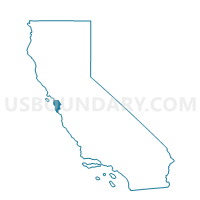
Outline

Summary
| Unique Area Identifier | 542876 |
| Name | Voting District 30305 |
| County | San Mateo County |
| State | California |
| Area (square miles) | 3.02 |
| Land Area (square miles) | 3.02 |
| Water Area (square miles) | 0.00 |
| % of Land Area | 100.00 |
| % of Water Area | 0.00 |
| Latitude of the Internal Point | 37.63989970 |
| Longtitude of the Internal Point | -122.48217300 |
Maps


Graphs
Select a template below for downloading or customizing gragh for Voting District 30305, San Mateo County, California


Neighbors
Neighoring Voting District (by Name) Neighboring Voting District on the Map
- Voting District 10055, San Mateo County, CA
- Voting District 10080, San Mateo County, CA
- Voting District 10081, San Mateo County, CA
- Voting District 10085, San Mateo County, CA
- Voting District 30295, San Mateo County, CA
- Voting District 30310, San Mateo County, CA
- Voting District 30315, San Mateo County, CA
- Voting District 50910, San Mateo County, CA
- Voting District 50915, San Mateo County, CA
- Voting District 50940, San Mateo County, CA
- Voting District OCEAN, San Mateo County, CA
Top 10 Neighboring County Subdivision (by Population) Neighboring County Subdivision on the Map
Top 10 Neighboring Place (by Population) Neighboring Place on the Map
- Daly City city, CA (101,123)
- South San Francisco city, CA (63,632)
- San Bruno city, CA (41,114)
- Pacifica city, CA (37,234)
Top 10 Neighboring Elementary School District (by Population) Neighboring Elementary School District on the Map
- Jefferson Elementary School District, CA (86,757)
- Laguna Salada Union Elementary School District, CA (36,664)
- San Bruno Park Elementary School District, CA (36,417)
Top 10 Neighboring Secondary School District (by Population) Neighboring Secondary School District on the Map
Top 10 Neighboring Unified School District (by Population) Neighboring Unified School District on the Map
Top 10 Neighboring State Legislative District Lower Chamber (by Population) Neighboring State Legislative District Lower Chamber on the Map
Top 10 Neighboring State Legislative District Upper Chamber (by Population) Neighboring State Legislative District Upper Chamber on the Map
Top 10 Neighboring 111th Congressional District (by Population) Neighboring 111th Congressional District on the Map
Top 10 Neighboring Census Tract (by Population) Neighboring Census Tract on the Map
- Census Tract 6026, San Mateo County, CA (8,167)
- Census Tract 6010, San Mateo County, CA (6,913)
- Census Tract 6016.05, San Mateo County, CA (6,189)
- Census Tract 6027, San Mateo County, CA (5,795)
- Census Tract 6140, San Mateo County, CA (5,458)
- Census Tract 6037, San Mateo County, CA (5,430)
- Census Tract 6028, San Mateo County, CA (4,522)
- Census Tract 6030, San Mateo County, CA (4,143)
- Census Tract 6029, San Mateo County, CA (3,846)
- Census Tract 6031, San Mateo County, CA (3,275)